More rain, high water in store for county *updated 7:21 p.m.
Published 7:35 pm Sunday, October 4, 2015
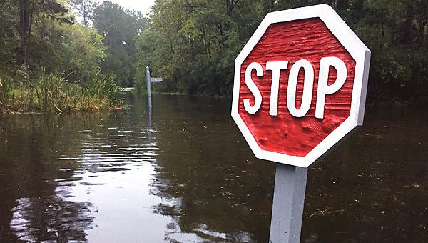
Water on Live Oak Lane reached a depth of 12 inches by Sunday afternoon in Washington’s Pamlico Plantation. (Ashley Vansant / Daily News)
10/05/15: 7:21 p.m.
Beaufort County Emergency Management Director John Pack updated county commissioners at their regular meeting Monday night. Pack said he’d checked the flood gauge at the U.S. Highway 17 bypass bridge on his way to the meeting, and it read that it was above flood stage.
“Water’s going to stay high,” Pack said.
Pack said NWS had revised its estimates as to when Beaufort County would see receding water and sunshine. While the rain will let up, northeasterly winds will continue to push water up the Pamlico and Pungo rivers until Thursday, he said.
Pack thanked fire chiefs throughout the county and others who have orchestrated welfare checks for shut-ins, as well as performing eight animal rescues. He said several of those included moving chained dogs in chest-deep water and two horses that were standing in water.
10/05/15: 2:35 p.m.
A 24-hour system moving through eastern North Carolina, on top of two weeks of continual rain, has flooded many roads across the county. The water may continue to rise, according to officials.
“This is absolutely the most water we’ve seen outside of a hurricane,” said Woody Jarvis, Belhaven’s town manager.
Monday afternoon, a northeasterly wind was pushing more water into the town, flooding main roads into and out of Belhaven and causing continued hardship for town residents and business owners, Jarvis said.
“We have more water than we were thinking we’d get. It’s in several of the businesses. I haven’t had any confirmed reports of it being in houses, but I’m sure it is,” Jarvis said. “This is going on two weeks that several of the businesses have not been able to open. It’s really, really hard on some of our businesses.”
Throughout the county, low-lying areas are being undated with the continued rain and rising creeks and rivers. According to Beaufort County Fire Marshal Curtis Avery, Aurora (around Hickory Point), areas around Blounts Creek, Whichards Beach Road, many of the roads feeding into the end of River Road outside of Washington, as well as East Main Street surrounding Jack’s Creek bridge.
Avery said the highest water, however, is in Pamlico Beach, an area that was hit hard during Hurricane Irene in 2011.
“I haven’t seen any homes that have flooded, but there may be (some) around Pamlico Beach,” Avery said.
Avery said the water will likely rise before it’s over.
“I heard this morning, it was a 24-hour system coming through,” Avery said. “With this rain we’re getting ready to get, we could get more rise.”
In Washington, continual pumping of Jack’s Creek has prevented flooding in the neighborhoods north of the East Third Street/Park Drive pumping station, according to Washington Police and Fire Services Director Stacy Drakeford.
Farther east, widespread flooding of local roads has led to the National Guard and a swift-water rescue team being called into Swan Quarter and shelter opened on Main Street, according to an advisory from Sarah Johnson, county public information officer.
“While N.C. Highway 264 is clear, many local roads are flooded with deep water,” the advisory reads.
All ferry routes to Ocracoke Island and visitor access is still prohibited as Ocracoke Village has standing water on many streets and several areas along N.C. Highway 12 have suffered dune breaches, resulting in overwash from high seas.
A National Weather Service coastal flood warning for areas adjacent to the Pamlico Sound and the Neuse, Pamlico and Pungo rivers remains in effect until 8 p.m. Monday.
County officials warn residents to stay off the roads if possible, but those who must drive should drive slowly through standing water — wakes from vehicles cause unnecessary property damage to those homes and businesses in flooded areas.
10/04/15: 8 p.m.
The National Weather Service has issued a coastal flood warning for areas adjacent to the Pamlico Sound, Neuse, Pamlico and Pungo rivers. Water levels will be 2 to 4 feet above normal peaking around times of high tide. The flood warning is in effect until 8 p.m. Monday.
According to NWS, some roads along the Pamlico River are reporting up to four feet of water on them and are impassible. Beaufort County Emergency Management has sent a message to residents to be aware that there are several bridges and streets in the county that have excessively high water. Travelers are warned to slow down, look out for ponding water on roadways and not drive through standing water.
A wind advisory remains in effect until midnight. Northeast winds blowing 10-25 miles per hour, with gusts up to 35 miles per hour are expected, according to the NWS. Downed trees, power lines and isolated power outages are possible. Winds can mike driving difficult, especially for high profile vehicles.
NCDOT ROAD CLOSURES:
SR-1166 (Whichards Beach Road), heading east near US-17 is closed due to high water. In effect until 1 p.m., Oct. 6.
SR-1416 (Sheppard Mill Road), heading west near SR-1001 (Cherry Run Road) is closed due to high water. In effect until 1 p.m., Oct. 5.
For updated travel information from the NCDOT click HERE.
More News


-
Polls
 Loading ...
-
-