Isaias will bring increased storm surge threat
Published 9:46 am Monday, August 3, 2020
|
Getting your Trinity Audio player ready...
|
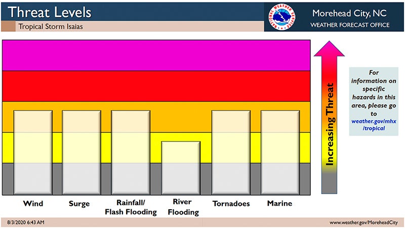
Tropical Storm Isaias could be a low category 1 hurricane by the time it makes landfall near the North Carolina/South Carolina border tonight.
Local impacts are expected to remain the same, with one exception: an increased threat of storm surge, from 2 to 4 feet above normally dry ground adjacent to bodies of water.
“This morning’s update made a slight adjustment forward in the timing of conditions for Beaufort County. Our winds are now forecasted to begin increasing after 10 p.m. tonight. The height of these winds are expected to occur between 11 p.m. and 4 a.m., with most areas commonly experiencing winds between 40 and 55 mph, with gusts of 55 to 70 mph possible,” Beaufort County Emergency Services Deputy Director Chris Newkirk wrote in this morning’s update.
Erik Heden, National Weather Service Newport/Morehead City warning coordination meteorologist, said there is little difference between a strong tropical storm and a low category 1 hurricane.
“There is a potential for strong winds across all of eastern North Carolina,” Heden said in the 8:30 a.m. NWS briefing.
Because Isaias is currently on a track west of eastern North Carolina, the southeasterly winds could impact storm surge.
“The biggest concern, on the sound side, is (water) funneling up the Neuse to New Bern, funneling up the Pamlico to Washington and funneling up the Pungo to Belhaven,” Heden said.
Rainfall totals are forecasted to be 1.5 to 2 inches, with greater amounts west of Beaufort County.
The track to the west enhances the chance of tornadoes in the area. Heden encouraged residents of eastern North Carolina to listen to NOAA radio and have multiple ways to receive tornado warnings. Beaufort County residents are also encouraged to sign up for Hyper-Reach, the county’s warning system, that delivers messages by phone call, email or text. To sign up for Hyper-Reach, visit the county’s website at co.beaufort.nc.us and scroll down to the red Hyper-Reach link on the home page.
Heden said the “good news” is that Isaias will be moving quickly and will be in and out of the area in a matter of hours.
To view the 6:30 a.m. PDF update from the National Weather Service Newport/Morehead City, click HERE. To view the entire NWS webinar click HERE.
More Beaufort County


-
Polls
 Loading ...
-
-