Severe weather possible Friday-Saturday
Published 9:24 am Friday, December 4, 2020
|
Getting your Trinity Audio player ready...
|
*UPDATE: The 4pm update from the National Weather Service (NWS) has increased the threat level of severe weather for Beaufort County. This adjustment moved our area into the “Slight” category for severe storms (meaning scattered severe storms are possible), and also elevated our potential wind gust to 35 – 40mph. No adjustments were made to the timing and rainfall totals. Please take a moment this afternoon to ensure that you, your family, friends and neighbors have a way of receiving watch / warning notifications should any be issued overnight. (weather radios, push notifications from local media apps etc.)
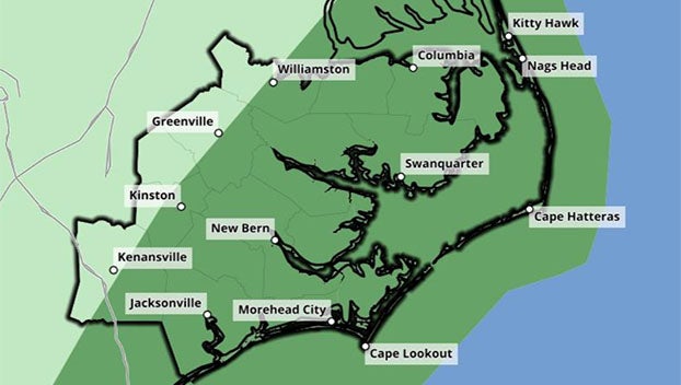
Beaufort County Emergency Services is currently monitoring an approaching weather system that has the potential to bring periods of heavy rain, damaging wind gust and isolated tornados to our area. The current forecast for Beaufort County is as follows:
Rain
- Rain chances will begin to increase after sunset today, and continue through 4am tomorrow. Our heaviest rains are expected between 10pm and 1am. ½” -1” of rain is possible through Sunday morning.
Winds
- SW/W winds will begin to increase after 9 p.m. tonight, becoming sustained between 15 and 20mph through 4 a.m. Gust of 30 to 35mph are possible during this time.
- A Gale Warning has been issued for the Pamlico and Pungo rivers from 4 a.m. – 10 a.m. Saturday morning. West winds of 20 to 25kt, with gust of 35kt and rough waters are expected. These winds are expected to cause abnormally low water levels of up to 2’ below normal between 4 a.m. and 4 p.m. tomorrow.
Tornados / Severe Thunderstorms
- The greatest chance of severe thunderstorms and possible tornados will be between 10p and 2am. However, storms are possible anytime between sunset tonight and 4am tomorrow morning.
See the briefing from the National Weather Service for additional information.
— Chris Newkirk, Deputy Director
More Weather

-
Polls
 Loading ...
-
-