Severe weather threat later today
Published 10:22 am Friday, May 6, 2022
|
Getting your Trinity Audio player ready...
|
From Chris Newkirk / Beaufort County Emergency Services
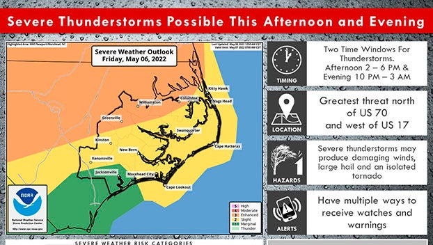
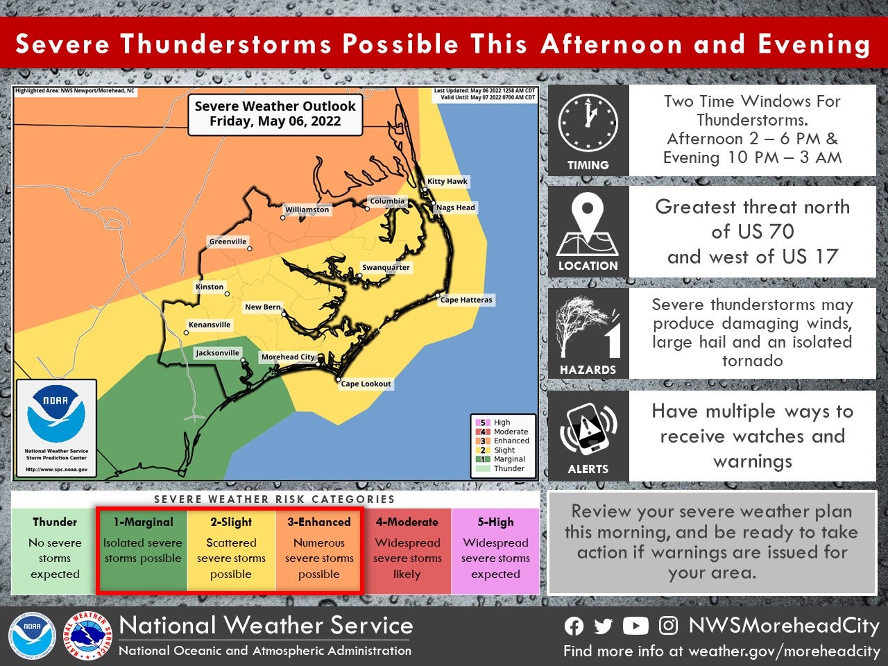
Our office is monitoring an increasing potential of severe weather for our county later today, especially for areas along and west of Hwy 17. Storms capable of producing heavy rain, large hail, damaging winds and isolated tornados are forecasted to develop across Eastern NC between 2pm and 1am, with the greatest chance occurring around 11pm tonight.
Please see the email below and attached briefings for the latest update from the National Weather Service.
We encourage everyone to continue to monitor local media outlets for any watches and / or warnings that may be issued.
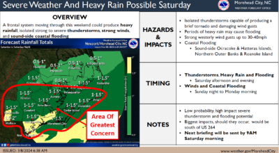
From the NWS - Morehead City
We continue to monitor the potential for severe weather today, with a first round of thunderstorms possible beginning early this afternoon, then another round later this evening and overnight. The greatest threat for severe weather exists generally north of Kinston and Washington. Please see the attached one-pager for more information.
Additionally, we are still expecting a prolonged period of coastal hazards as low pressure remains nearly stationary off our coast Sunday through Wednesday of next week. Winds have trended a bit stronger with the latest forecast update, increasing confidence that the area will experience impacts from ocean overwash and coastal flooding. Dangerous surf conditions and strong rip currents are also expected. Please see the other attached one-page briefing for more information on this system.
 NWS Morehead City Coastal Flooding 1 Pager #2 May 6th 2022
More Weather

-
Polls
 Loading ...
-
-