Hurricane Ian: Sept. 29 AM update
Published 10:46 am Thursday, September 29, 2022
|
Getting your Trinity Audio player ready...
|
From Chris Newkirk, Beaufort County Emergency Services
Please see the email below and attached briefing for the latest update from the NWS.
We are continuing to monitor subtle shifts in the track and timing associated with Hurricane Ian, as well as how those changes are forecasted to impact our area. Changes as a result of this morning’s updates have been highlighted below.
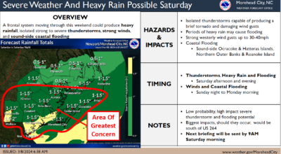
Rain
- 4 to 6 inches of rain is forecasted for our area, with 6 to 8 inches possible for areas south of Hwy 264 and east of Blounts Bay / Bath. Our greatest chance of rain and highest hourly accumulation is currently forecasted to occur between 3am Friday morning and sunrise Saturday. Heavy downpours capable of causing localized flash flooding is possible during this time.
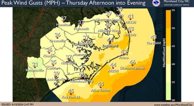
Winds
- Winds are currently forecasted to be sustained between 15 and 20 mph Thursday through Saturday, with frequent gust of 30 – 40 mph possible during this time.
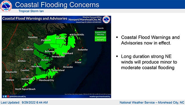
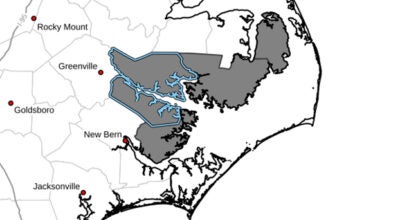
Storm Surge
- A Coastal Flood Watch has been issued for Beaufort County. Persistently high NE winds will beginning transitioning to the east around sunset Friday, becoming SE by midnight and S by sunrise. These conditions are expected result in the following:
- 2 to 4 feet of inundation is expected along the coastal areas of the Pamlico River. (Areas near the back of Chocowinity Bay and west of Washington are expected to be on the higher side of this scale.)
- 1 to 3 feet is expected for areas along the Pungo River.
Note: These values and timelines may change with future updates.
We will continue to pass along information as we receive it.
From NWS Newport/Morehead City:
Our overall impacts from a prolonged period of wind, rain and elevated waters from both Ian and other weather features, HAVE NOT CHANGED. We still expect a long duration of elevated waters through multiple high tide cycles.
Changes from last briefing:
- Tropical Storm WARNING issued from Cape Lookout south
- Some minor adjustments to the coastal flooding/surge threat
- High Surf Advisory has been issued from Cape Lookout north to Duck
Please see the attached briefing for additional details. Remember, you can monitor conditions in the tropics at https://www.weather.gov/mhx/tropical.
NWS Morehead City Hurricane Ian Briefing #11 Sep 29th 2022
More Weather

-
Polls
 Loading ...
-
-