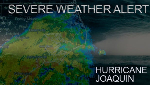
Hurricane Joaquin: NWS alerts, updates
Published 4:11 pm Wednesday, September 30, 2015
10/02/15: 10:30 a.m.
Hurricane Joaquin is no longer a threat to make landfall in the U.S. but the rain this tropical system will bring to the area is still a concern. According to the National Weather Service, an additional 1 to 3 inches of rain is expected through tonight, with potentially higher amounts in localized areas.
Some city streets in Washington have been blocked off due to high water. Beaufort County Schools also announced children will be released 3 hours early today, in response to the continuing bad weather.
10/01/15: 11:45 p.m.
Looks like Hurricane Joaquin is heading on an eastern track, according to the National Weather Service. Current models place the category 4 storm well off the North Carolina coast in the coming days. A flood watch is still in effect for Beaufort County because of new rainfall on top of the the 5 to 8 inches the area has received in the past week. Flooding and trees downed are still a concern until this tropical system passes by.
10/01/15: 8 p.m.
Hurricane Joaquin continues to track eastward in new models. According to the National Weather Service, strong majority of the forecast models are now in agreement on a track farther away from the United States east coast. NWS is becoming optimistic that the Carolinas and the mid-Atlantic states will avoid the direct effects from Joaquin. However, we cannot yet completely rule out direct impacts along on the east coast, and residents there should continue to follow the progress of Joaquin over the next couple of days.
10/01/15: 4 p.m.
Hurricane Joaquin has intensified to a category 4 hurricane. While latest hurricane models have Joaquin on an increasingly eastward track, Beaufort County officials remain concerned that the amount of rain expected in eastern North Carolina over the next few days will cause flooding. The county is under a National Weather Center flood watch until Saturday because of the estimated rainfall of 3 to 5 inches.
“I don’t want to say we’re out of the woods yet, but at the same time we’re better off than we were at 5 p.m. yesterday,” said Beaufort County Emergency Management Director John Pack.
There are no plans to close Beaufort County Schools on Friday, though Monday is still uncertain.
According to Associate Press, North Carolina Gov. Pat McCrory declared a state of emergency for the entire state to help prepare for a possible thrashing by Hurricane Joaquin. Rain and wind from the Category 4 storm threaten to pummel the state this weekend. McCrory says his declaration allows exceptions to weight and time restrictions on trucks while also giving him added authority to respond to trouble.
McCrory says Outer Banks towns are facing special risks because rain there has been coming nearly nonstop for a week followed by a weekend nor’easter that’s chewed up protective sand dunes.
McCrory says up to 10 inches of rain could fall in parts of the state’s western mountains and foothills, and that water pouring downhill could cause damage to communities there.
10/01/15: 12:15 p.m.
Beaufort County officials met at EOC this morning to discuss preparation for Hurricane Joaquin. Joaquin is a category 3 storm, expected to strengthen to a category 4 over today. The newest models have it on a more eastward track, skirting past the Outer Banks. Officials say Beaufort County may be getting 3 to 5 inches of rain and tropical storm winds (around 40 mph), but that could be just gusts. This could be overnight Sunday into Monday morning, though Emergency Management Director John Pack said we’re looking at that lasting for only a 2 to 3 hour period.
There are no plans to close Beaufort County Schools on Friday, though Monday is still uncertain.
Beaufort County is still under a flood watch issued by the National Weather Service. Combined with the amount of rain the county has seen over the past week, the rain expected over the next several days have authorities concerned about high water not necessarily during the time Joaquin passes by, but in the day following.
Officials will know more after the 10 p.m. update tonight.
10/01/15: 8 a.m.
Joaquin is a category 3 hurricane with sustained winds of 120 mph. It is expected to strengthen to a category 4 storm today. A hurricane watch for portions of the East Coast may be issued as early as tonight. Potential tracks have diversified, though most still show the Carolinas affected by Joaquin, with either a brush or direct hit.
City, county and state officials meet today at 11:15 a.m. at EOC to discuss a plan of action. Now is the time to prepare for Hurricane Joaquin.
10/01/15: 12:01 a.m.
Joaquin has become a category 3 hurricane. Sustained winds are at 115 mph. Path is still uncertain as several weather systems are impacting Joaquin, but currently landfall in North Carolina or Virginia is projected.
According to the National Weather Service, many portions of the eastern U.S. are currently experiencing heavy rains and gusty winds associated with a frontal system. These heavy rains are likely to continue for the next few day, even if they center of Joaquin stay offshore. The resulting inland flood potential could complicate prepartions for Joaquin should it head toward the coast, and even more substantial inland flooding is possible if Joaquin later passes near or over these same areas.
With 4 to 7 inches of rain expected in Beaufort County over the next several days, on top of the five to 8 inches that’s fallen over the past week, the National Weather Service has issued a flood watch in effect from Thursday until Saturday night.
Make sure you are hurricane prepared.
9/30/15: 9:30 p.m.
Joaquin is now a category 2 hurricane and is expected to strengthen over the next several days. Hurricane models are still undecided as to an actual track, but North Carolina is definitely right in the middle of potential paths. The fact that Beaufort County has already seen an estimated 5 to 8 inches of rain over the past five days and more rainfall is expected means officials are increasingly concerned about flooding and downed trees.
Current National Weather Center data puts Joaquin over Kill Devil Hills at 2 p.m. on Sunday.
Now is the time to make sure hurricane kits are up-to-date.
9/30/2015: 5 p.m.
New track has Joaquin making landfall on the Outer Banks at 2 p.m Sunday. The National Weather Service is now saying that Hurricane Joaquin’s generally southwestward motion is expected for the next 36 hours or so, followed by a turn toward the north. All models, with the exception of the ECMWF, are predicting that landfall in the Carolinas and the mid-Atlantic states. Additional intensification is expected to continue over the next 48 hours.
9/30/2015: 4 P.M.
No clear track yet for Hurricane Joaquin. Many models project Joaquin will make landfall somewhere along the East Coast, with the majority tracking over North Carolina and Virginia. Joaquin is a category 1 hurricane, the third hurricane of the season. It is expected to strengthen over the next day.
National Weather Service issues flood watch
According to NWS, another 4 to 7 inches of rain is expected from Thursday night to Saturday morning. NWS has issued a flood watch for most of eastern North Carolina, including Beaufort County, until Saturday night.
“This amount of rain will produce widespread ponding of roadways and flooding of urban and poor drainage areas especially with the ground already saturated. Drainage ditches may also overflow onto roadways and even flooding of more rural areas is possible. Streams and rivers are also expected to rise,” according to NWS.
Beaufort County has received an estimated 5 to 8 inches of rain over the last five days, varying on location. Emergency management warns that ground saturation means greater risk of flooding and trees downed regardless of whether Joaquin is a direct hit or not.
City, county and state personnel meet Thursday at 11:15 a.m. at EOC to discuss emergency plan.
More News


-
Polls
 Loading ...
-
-