‘Not out of the woods’ as Joaquin tracks east
Published 8:08 pm Thursday, October 1, 2015

VAIL STEWART RUMLEY | DAILY NEWS
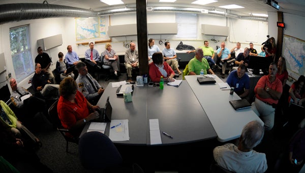
PREPARATION: City, county and state officials met Thursday to discuss the county’s hurricane preparedness as category 4 Hurricane Joaquin threatens the East Coast.
Thursday, Beaufort County residents got relatively good news in relation to the category 4 storm threatening the East Coast.
City, county and state officials gathered at the county’s Emergency Operations Center on Thursday morning for a briefing on Hurricane Joaquin and discussion of county preparedness in response to the hurricane’s potential effects.
“I don’t want to say we’re out of the woods yet, but at the same time, we’re better off than we were about 5 p.m. yesterday,” Beaufort County Emergency Management Director John Pack told the assembled group.
With hurricane models Thursday projecting Joaquin on an increasingly eastward track, Pack said Beaufort County could still experience 3 to 5 inches of rain and tropical storm force winds should the hurricane brush past the Outer Banks.
Joaquin strengthened from a category 3 to category 4 hurricane Thursday, with sustained winds of 125 mph, as it hovered over the Bahamas. But unlike Hurricane Irene in 2011, Joaquin will move quickly and tropical weather likely will be short-lived over Sunday or Monday.
“This is fast mover. We’re talking four to six hours. If it keeps on the same track we’ll only see tropical storm winds, maybe even just gusts, for two to three hours,” Pack said.
According to Beaufort County Schools Superintendent Don Phipps, schools are open Friday, but officials are waiting to see what Joaquin will do before making a decision about Monday.
The main concern for Beaufort County residents is possible flooding caused by more rain on the already saturated soil of eastern North Carolina, according to county officials. Over the past week, between 5 and 8 inches of rain has fallen in the area, pushing some rivers and creeks up to or near flood stages. Near Greenville, NOAA flood gauges put the Tar River at one foot below flood stage and for five consecutive days this week, Belhaven registered above flood stage, Pack said.
According to Belhaven town manager Woody Jarvis, Belhaven can handle the high water as long as the wind stays out of the west.
“It can turn on a dime if it’s out of the east,” Jarvis said.
Washington Fire Chief Robbie Rose said Police and Fire Services are prepared to block off flooded streets on an as-needed basis, while NCDOT representatives are keeping an eye on roads that historically flood, including VOA and Cherry Run roads near Washington and parts of Gray Road in Chocowinity.
But other roads are certainly at risk because of the excessive rainfall, leading Pack to issue this warning to the public: “People should not drive through standing water.”
Later on Thursday, Beaufort County Emergency Management issued a press release addressing potential flooding: “Joaquin’s path remains uncertain. However, with heavy rain expected to continue through the week and weekend, the risk of flooding is quickly increasing. Beaufort County Emergency Management is recommending that anyone that lives or has a business or property in low lying and flood prone areas take precautions now should evacuation become necessary. Heavy rainfall may cause floodwater to rise rapidly with little or no warning.”


