Heavy rain, storm surge expected with Dorian
Published 3:40 pm Monday, September 2, 2019
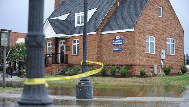
- Hurricane Florence’s floodwater approach the Washington-Beaufort County Chamber of Commerce in September 2018.
Though not expected to be a direct hit, Hurricane Dorian is forecasted to unleash heavy rainfall, flooding and storm surge in eastern North Carolina, according to the National Weather Service in Newport/Morehead City.
“The majority of impacts will be on Thursday and possibly up to Friday morning,” said Tony Saavedra, the observation program leader for NWS Newport/Morehead City. “It’s still expected to stay over the water, but it’s inching close — every time we look at the track it’s inching closer — but they have not brought it on land.”
Monday afternoon, the category 4 Dorian continued a westward drift toward the coast of Florida after causing massive destruction to islands of the Bahamas as a category 5 storm with sustained winds of 185 mph and gusts of up to 220 mph. Today, Dorian is expected to make a turn toward the northwest near the east coast of Florida; tomorrow, a turn northeast toward the Carolinas, according to a Monday update from the National Hurricane Center. Meteorologists are calling for a gradual weakening of the storm, yet its wind field is forecasted to expand.
Saavedra said, if Dorian sticks with the offshore track, it represents “a little bit of good news” that eastern North Carolina would be in the storm’s northwestern quadrant. While Dorian will likely impact the area as a category 1 or category 2 hurricane, officials are warning residents not to focus on the category alone.
“The winds are dangerous, but the storm surge is the more dangerous part,” Saavedra said. “For us, it’s definitely going to be storm surge, leading ahead of the storm.”
Saavedra said as Dorian approaches, water will be pushed into the sounds and rivers, particularly along the southern coast. As Dorian draws parallel to the coast, locations such as Hatteras will see flooding as wind out of the north piles water up behind the barrier island. Saavedra said Monday afternoon no predictions had been made as to what Beaufort County waterways are looking at in terms of storm surge.
“Right now, it is too soon to tell,” Saavedra said. “Based on the tracking, they’ll be able to pinpoint with more accuracy how much storm surge we’re going to get.”
“The National Weather Service is really hammering on ‘Don’t focus on the category, don’t get hung up on the category. And don’t get focused on the exact track even if it’s off the coast,” said Beaufort County Manager Brian Alligood. Alligood said conference calls between county and Beaufort County Emergency Services staff and state emergency management offices, as well as NWS officials, have been ongoing since Saturday.
“We’re going to have some impact, obviously, but folks need to go ahead and get prepared and don’t take it lightly,” Alligood said.
Storm surge and tropical storm or hurricane force wind potential is highly track dependent, according a local NWS discussion. Based on the track forecasted early Monday morning, the greatest threat for damaging winds exists along coastal areas, including coastal Onslow County, the Crystal Coast and the Inner and Outer Banks. The greatest threat for storm surge exists across the southern Pamlico Sound shorelines, including sound side of the southern Outer Banks and the shores of the Neuse River.
“However, it must be stressed that even minor adjustments in the track could result in significant changes to the threats, and all residents of eastern North Carolina should be preparing for hurricane force winds and interests vulnerable to storm surge should monitor subsequent forecasts closely,” the update reads.
The exact location of the highest precipitation will depend on Dorian’s track, but the threat for heavy rainfall and flash flooding will likely extend across most of eastern North Carolina.
Alligood said residents should be prepared and pay attention to the warnings.
“The biggest thing for us is to tell folks to heed evacuation warnings. There will be a point in the storm where our folks will not be able to get out,” Alligood said. “Don’t risk your lives and our first responders’ lives because you decided not to heed a warning.”
More News


SportsPlus
Buy Tickets for Carolina Hurricanes vs. Pittsburgh Penguins on October 18
The Carolina Hurricanes and Pittsburgh Penguins square off at PPG Paints Arena on Friday, October 18 at 7:00…
WNBA Betting Picks: Friday, Oct. 18
Wondering how you should bet on today’s WNBA game? Look no further. Below you’ll find computer predictions on…
Brent Burns Player Prop Bets for the Hurricanes vs. Penguins Game – October 18
Brent Burns will be on the ice when the Carolina Hurricanes and Pittsburgh Penguins meet at PPG Paints…
Sebastian Aho Player Prop Bets for the Hurricanes vs. Penguins Game – October 18
Sebastian Aho and the Carolina Hurricanes will play on Friday at 7:00 PM ET, versus the Pittsburgh Penguins.…
Shayne Gostisbehere Player Prop Bets for the Hurricanes vs. Penguins Game – October 18
Shayne Gostisbehere will be on the ice when the Carolina Hurricanes and Pittsburgh Penguins face off on Friday,…
-
Polls
 Loading ...
-
-