Sheriff’s Office offers local road closure map
Published 3:11 pm Thursday, September 5, 2019
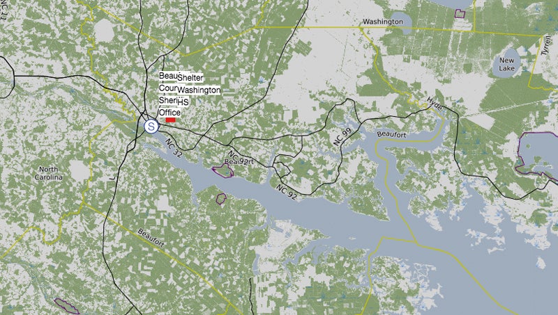
- The SARTOPO site shows road closures and impediments as they are reported to Beaufort County 911.
The Beaufort County Sheriff’s Office has activated a website showing a map of road closures for the County during Hurricane Dorian. The site is being maintained by the county’s 911 department and shows closures and impediments as they are reported.
The site can be accessed at sartopo.com/m/QED0.
Area residents should to avoid traveling when possible, especially during the height of the storm. As always, remember not to drive through standing water, and be aware of potential hazards from downed power lines. Turn around, don’t drown.
More ZZ - News Main


SportsPlus
How to Watch the MLB Baseball Playoffs on Saturday, Oct. 5: TV Channel, Live Streaming, Start Times
The San Diego Padres and the Los Angeles Dodgers take the field for one of many compelling matchups…
MLB Playoff Betting Lines and Picks Today | Oct. 5
The MLB Playoff outings in a Saturday schedule sure to please include the San Diego Padres taking on…
Best Bets, Odds for the Panthers vs. Bears Game – Week 5
The Chicago Bears (2-2) take on the Carolina Panthers (1-3) at Soldier Field on Sunday, October 6, 2024.…
Where to Watch East Carolina vs. Charlotte on TV or Streaming Live – Oct. 5
On Saturday at 3:30 p.m. ET, Anthony Smith and the East Carolina Pirates (3-2) will take on the…
Where to Watch Panthers vs. Bears on TV or Streaming Live – Oct. 6
The Carolina Panthers (1-3) are set for a road game against the Chicago Bears (2-2) at Soldier Field…
-
Polls
 Loading ...
-
-