Tropical Storm Watch issued for Beaufort County
Published 5:05 pm Tuesday, August 29, 2023
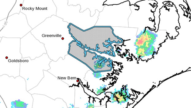
- (National Weather Service)
|
Getting your Trinity Audio player ready...
|
500 PM EDT Tue Aug 29 2023…STORM SURGE WATCH IN EFFECT…
…TROPICAL STORM WATCH IN EFFECT…
A Storm Surge Watch means life-threatening inundation, from rising water moving inland from the coastline, is possible somewhere within this area within the next 48 hours.
A Tropical Storm Watch means tropical storm-force winds are possible somewhere within this area within the next 48 hours.
* LOCATIONS AFFECTED
– Washington
– Belhaven
– Aurora
* WIND
– LATEST LOCAL FORECAST: Below tropical storm force wind
– Peak Wind Forecast: 15-25 mph with gusts to 35 mph
– THREAT TO LIFE AND PROPERTY THAT INCLUDES TYPICAL FORECAST UNCERTAINTY IN TRACK, SIZE AND INTENSITY: Potential for wind 39 to 57 mph
– PLAN: Plan for hazardous wind of equivalent tropical storm force.
– PREPARE: Efforts to protect property should now be underway. Prepare for limited wind damage.
– ACT: Act now to complete preparations before the wind becomes hazardous.
– POTENTIAL IMPACTS: Limited
– Damage to porches, awnings, carports, sheds, and unanchored mobile homes. Unsecured lightweight objects blown about.
– Many large tree limbs broken off. A few trees snapped or uprooted, but with greater numbers in places where trees are shallow rooted. Some fences and roadway signs blown over.
– A few roads impassable from debris, particularly within urban or heavily wooded places. Hazardous driving conditions on bridges and other elevated roadways.
– Scattered power and communications outages.
* STORM SURGE
– LATEST LOCAL FORECAST: Life-threatening storm surge possible
– Peak Storm Surge Inundation: The potential for 2-4 feet above ground somewhere within surge prone areas
– Window of concern: Begins Thursday afternoon
– THREAT TO LIFE AND PROPERTY THAT INCLUDES TYPICAL FORECAST UNCERTAINTY IN TRACK, SIZE AND INTENSITY: Potential for storm surge flooding greater than 3 feet above ground
– PLAN: Plan for life-threatening storm surge flooding of greater than 3 feet above ground.
– PREPARE: Storm surge flooding preparations should be underway. Assemble disaster supplies and know your evacuation route.
– ACT: Leave if evacuation orders are given for your area.
Failure to heed evacuation orders may result in the loss of your life.
– POTENTIAL IMPACTS: Significant
– Areas of inundation with storm surge flooding accentuated by waves. Damage to several buildings, mainly near the
coast.
– Sections of near-shore escape routes and secondary roads become weakened or washed out, especially in usually
vulnerable low spots.
– Major beach erosion with heavy surf breaching dunes. Strong and numerous rip currents.
– Moderate damage to marinas, docks, boardwalks, and piers. Several small craft broken away from moorings, especially in unprotected anchorages.
* FLOODING RAIN
– LATEST LOCAL FORECAST: Flood Watch is in effect
– Peak Rainfall Amounts: Additional 3-6 inches, with locally higher amounts
– THREAT TO LIFE AND PROPERTY THAT INCLUDES TYPICAL FORECAST
UNCERTAINTY IN TRACK, SIZE AND INTENSITY: Potential for
moderate flooding rain
– PLAN: Emergency plans should include the potential for moderate flooding from heavy rain. Evacuations and rescues
are possible.
– PREPARE: Consider protective actions if you are in an area vulnerable to flooding.
– ACT: Heed any flood watches and warnings. Failure to take action may result in serious injury or loss of life.
– POTENTIAL IMPACTS: Significant
– Moderate rainfall flooding may prompt several evacuations and rescues.
– Rivers and tributaries may quickly become swollen with swifter currents and overspill their banks in a few places, especially in usually vulnerable spots. Small streams, creeks, canals, and ditches overflow.
– Flood waters can enter some structures or weaken foundations. Several places may experience expanded areas of rapid inundation at underpasses, low-lying spots, and poor drainage areas. Some streets and parking lots take on moving water as storm drains and retention ponds overflow.
Driving conditions become hazardous. Some road and bridge closures.
* TORNADO
– LATEST LOCAL FORECAST:
– Situation is somewhat favorable for tornadoes
– THREAT TO LIFE AND PROPERTY THAT INCLUDES TYPICAL FORECAST UNCERTAINTY IN TRACK, SIZE AND INTENSITY: Potential for a few tornadoes
– PLAN: Emergency plans should include the potential for a few tornadoes.
– PREPARE: If your shelter is particularly vulnerable to tornadoes, prepare to relocate to safe shelter before hazardous weather arrives.
– ACT: If a tornado warning is issued, be ready to shelter quickly.
– POTENTIAL IMPACTS: Limited
– The occurrence of isolated tornadoes can hinder the execution of emergency plans during tropical events.
– A few places may experience tornado damage, along with power and communications disruptions.
– Locations could realize roofs peeled off buildings, chimneys toppled, mobile homes pushed off foundations or overturned, large tree tops and branches snapped off, shallow-rooted trees knocked over, moving vehicles blown off roads, and small boats pulled from moorings.
* FOR MORE INFORMATION:
– http://ready.gov/hurricanes
More Weather


SportsPlus
How to Watch MLB Baseball on Saturday, August 31: TV Channel, Live Streaming, Start Times
The Los Angeles Dodgers and the Arizona Diamondbacks square off in one of many compelling matchups on the…
How to Watch the WNBA Today | August 31
Today’s WNBA slate includes just one contest — the Connecticut Sun against the Washington Mystics. The WNBA is…
WNBA Betting Picks: Saturday, August 31
Wondering how you should bet on today’s WNBA game? Look no further. Below you’ll find computer predictions on…
Where to Watch East Carolina vs. Norfolk State on TV or Streaming Live – August 31
The Norfolk State Spartans (0-1) will visit the East Carolina Pirates on Saturday at 6:00 p.m. ET. We…
Washington Mystics vs. Connecticut Sun Betting Odds and Matchup Preview – Saturday, August 31
The Washington Mystics (9-22) will try to build on a three-game winning streak when hosting the Connecticut Sun…
-
Polls
 Loading ...
-
-